Which Dolomites hike gives a first-time visitor dramatic views without turning the day into an endurance test? The best answer is not always the shortest path. A true beginner route should have clear signs, a sensible escape option, manageable elevation gain, and a starting point that does not demand a long climb before the scenery begins.
The Dolomites reward careful planning. A route marked easy may still cross rough limestone, rise above 2,000 metres, or take longer than the sign suggests once you add photo stops, lunch, weather delays, and the return journey. The figures below are approximate, and conditions, lift operations, closures, and opening dates can change quickly. Check the local tourism office or trail map on the morning of your walk.
Beginner-friendly does not mean risk-free. It means the route gives you room to make sensible decisions.
Which Dolomites hikes are genuinely easy for beginners?
For a first mountain hike, choose the route with the smallest elevation gain, not simply the most famous view.
| Route | Distance | Elevation change | Best use |
|---|---|---|---|
| Col de Flam from Ortisei | 2.5 km | 125 m up and 125 m down | First short hike, village access |
| PanaRaida at Monte Pana | 2.6 km | 64 m up and 64 m down | Families and a gentle introduction |
| Puflatsch loop on Alpe di Siusi | About 8 km | About 300 m up | Panoramic half-day outing |
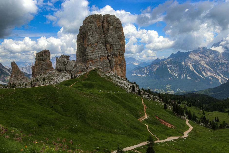
| Tre Cime summer loop | 8.8 km | About 550 m up | Confident beginners with good weather |
| Fischleintal to Talschlusshütte | 12.6 km | About 227 m up and 224 m down | Long valley walk with modest climbing |
PanaRaida is even gentler, but its adventure stations make it feel more like a family nature walk than a classic alpine hike.
The Puflatsch loop and Tre Cime route deserve a different label in your own plan: easy by mountain standards, not effortless. Four hours on uneven ground can feel much harder than four hours on a city pavement. The Tre Cime loop also exposes you to fast weather changes and crowds, so it should not be your first route after a late arrival or a poor night of sleep.
How should a beginner plan a first hiking day?
Use this sequence before leaving your accommodation. It takes less than fifteen minutes and prevents many avoidable problems.
- Choose the valley before choosing the trail. Val Gardena, Alpe di Siusi, Alta Badia, and the 3 Zinnen area are not interchangeable day bases. Crossing the region by car can consume the best walking hours, especially during busy summer periods.
- Set a hard turnaround time. If the route takes two hours to reach its main viewpoint, decide in advance that you turn back at a fixed time even if the view is still ahead. A mountain day becomes unsafe when the return starts after weather or daylight has worsened.
- Check three conditions. Look at the forecast for the exact elevation, confirm that the trail and any required lift are operating, and ask about thunderstorms, snow patches, rockfall, or temporary closures. A clear valley does not prove that a high trail is clear.
- Plan the transport home. A one-way walk is only beginner-friendly if the bus, lift, or pickup connection is reliable. Save the final departure time and one earlier option. Do not build a route around the last service of the day.
- Start slower than feels necessary. Walk for the first twenty minutes at a pace that allows full sentences. Early overexertion is common on steep paths because the scenery encourages people to push harder than they would on a normal walk.
- Leave a simple alternative. If the high route feels wrong, descend to a lower valley path, shorten the loop, or return to the starting point. A flexible plan is stronger than a heroic one.
Add at least thirty minutes to a short walk and more for a half-day route.
The best beginner decision is often made before the trailhead: stay in one valley for the day, begin early, and avoid combining two famous viewpoints just because they appear close together on a map.
What does a relaxed three-day Dolomites hiking itinerary look like?
A beginner itinerary should build confidence rather than chase the maximum number of landmarks. The following plan works best from a base in or near Val Gardena, with adjustments for weather and transport.
Day one: Ortisei and Col de Flam
Use the first morning to learn how your body responds to the altitude and uneven surface. Begin in Ortisei and follow the marked route toward Col de Flam. The official figures are about 2.5 kilometres, one hour, and 125 metres of ascent, with the same amount on the way down. That is enough walking to test shoes, pacing, hydration, and navigation without committing you to a remote ridge.
After the walk, keep the rest of the day local. A village stroll, a long lunch, or a visit to a small museum gives your legs time to recover. Do not add a second mountain route simply because the first one ended early.
Day two: Alpe di Siusi and a high meadow route
Move to the plateau only after checking access times and the day’s forecast. The Hans and Paula Steger Trail is designed as an easy walk between Compatsch and Saltria, with broad meadow scenery and few significant inclines. The Puflatsch loop is a stronger half-day option at roughly eight kilometres and 300 metres of ascent. Pick one, not both, if this is your first alpine holiday.
The plateau can look gentle while still creating sun exposure, wind, and long distances between transport points. Carry water, keep the map available, and treat a cloud-covered view as a valid reason to shorten the route.
Day three: choose Tre Cime only if the first two days went well
The Tre Cime loop is the visual headline of many Dolomites trips, but its easy classification should not override the numbers: approximately 8.8 kilometres, four hours, and 550 metres of ascent. Go only in stable weather, with enough daylight, and with legs that feel recovered. If the forecast is unstable, choose a lower valley walk instead. A famous route is not automatically the right route for that day.
What mistakes make an easy Dolomites hike difficult?
Starting too high and too fast
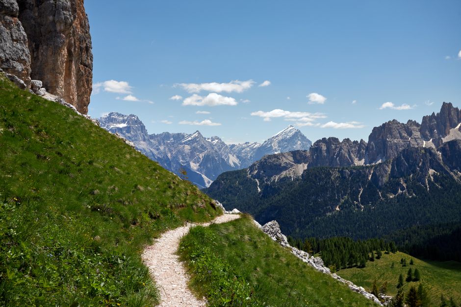
Cable cars and mountain roads can place you above 2,000 metres within minutes. The views arrive quickly, but your body still has to adjust to thinner air, stronger sun, and unfamiliar effort. Walk gently for the first thirty minutes. Headache, nausea, unusual breathlessness, or poor coordination are reasons to stop and descend rather than push toward the next landmark.
Trusting a label without reading the route
Easy does not mean flat, short, dry, or free from exposure. The Tre Cime loop is marked easy in official route information, yet its distance and ascent make it a serious half-day outing. Puflatsch is also a poor choice if you arrive late and need to catch a fixed connection. Read the numbers together and ask what happens if you turn back halfway.
Ignoring the descent
Beginners often train for uphill walking and forget that downhill terrain creates its own strain. Loose gravel, wet steps, and tired legs increase the chance of a slip. Shorten your stride, use stable contact, and keep space from the person ahead. If your knees begin to shake, take a real break before continuing.
Leaving the route for a better photograph
Stepping beyond a marked path can damage fragile meadow plants, disturb livestock, or put you near unstable rock. The safest viewpoint is the one that does not require a scramble. Stay on signed trails, close gates, and give animals a wide passage. A shortcut that saves ten minutes can create a much larger problem.
Other common mistakes include carrying too little water, assuming every hut is open, relying on a phone signal, and treating a late taxi or bus as guaranteed. Build your plan so one closed facility or missed connection does not leave you stranded.
When should you turn back or choose a lower route?
Turn back when the weather darkens over the ridge, thunder becomes audible, visibility removes the next trail marker, or the surface becomes more technical than the route description suggested; these are objective signals, not failures. Choose a lower valley walk when your group includes a first-time hiker, a child who is tiring, someone recovering from illness, or anyone showing headache, dizziness, or unusual shortness of breath, because altitude and fatigue can change quickly. Leave the Tre Cime loop for another day if the forecast is unstable, and replace it with a marked path in Fischleintal, Ortisei, or the lower Alpe di Siusi area where the route can be shortened more easily. The correct beginner verdict is simple: for a first Dolomites hike, Col de Flam is the best starting point because it combines a one-hour commitment, 125 metres of ascent, village access, and an easy return; once that feels comfortable, move to a high meadow half-day route, then consider the longer iconic loops.